Publications
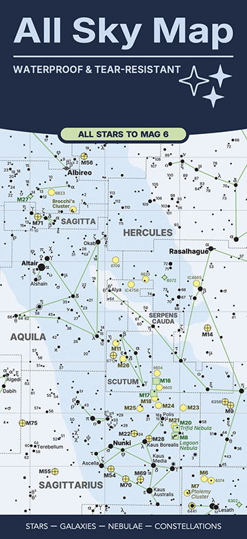
All Sky Map
Starplot can create publication-quality maps, thanks to its ability to export SVG files. These files can then be imported into many design applications, including Adobe Illustrator and Affinity Publisher, to create high-quality printed maps, books, etc.
One example is the All Sky Map, which is a foldable map designed and created by Steve Berardi (who also created Starplot!).
The map was created by first writing code to generate SVG files of the map and then these were imported into Affinity Publisher to fine-tune some of the label positions and add the legend, supporting text, and create the overall page layout of the map. It was then printed on synthetic paper that is waterproof and tear-resistant!

How to Cite Starplot
If you use Starplot to help create images for a publication, we'd greatly appreciate a citation. Please see Starplot's GitHub repo for an easy way to generate citations in different formats (on the repo's homepage, look to the right side under the "About" section). We also maintain a citation file.
We'd also love to list your publication on this page, so if you'd like to share please email Steve Berardi, or join us on our Discord server.