Examples
-
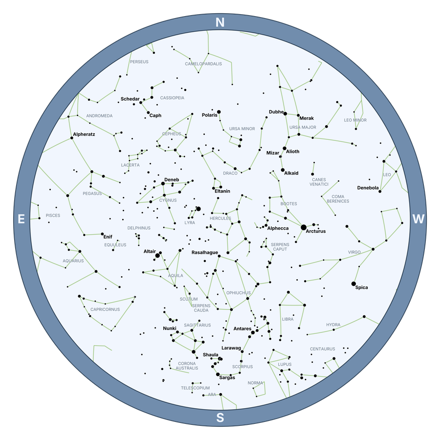
Basic Star Chart
-
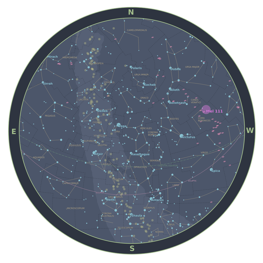
Detailed Star Chart
-
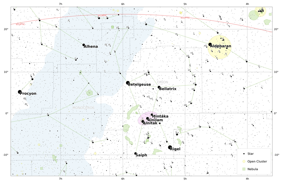
Map of Orion
-
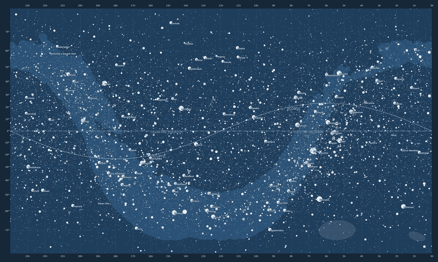
Big Map
-
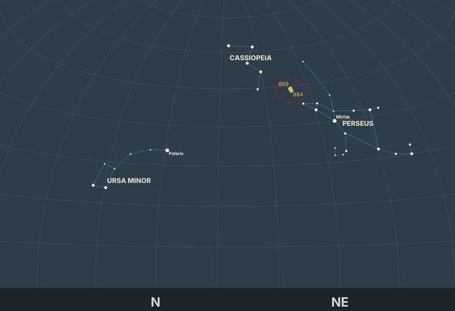
Finding the Double Cluster
-

Carina Nebula + Clusters
-

Horizon Gradient
-

Total Solar Eclipse 2024
-
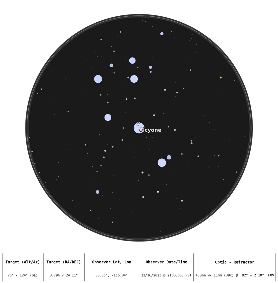
Optic Plot of the Pleiades
-
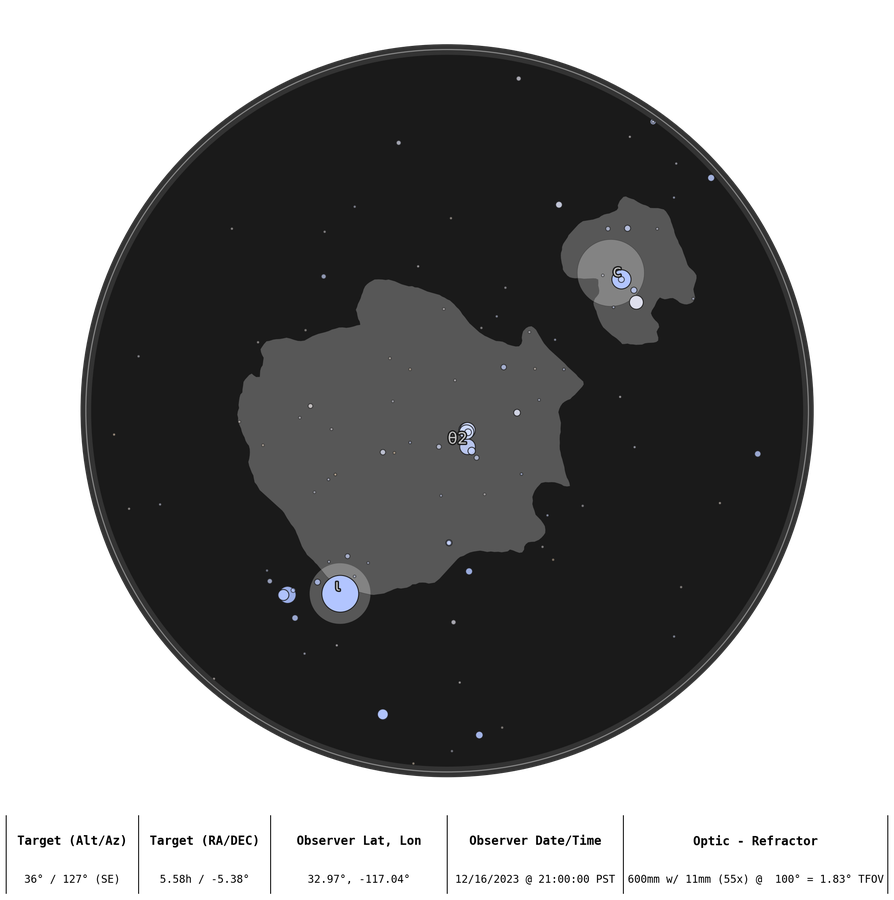
Optic Plot of the Orion Nebula
-
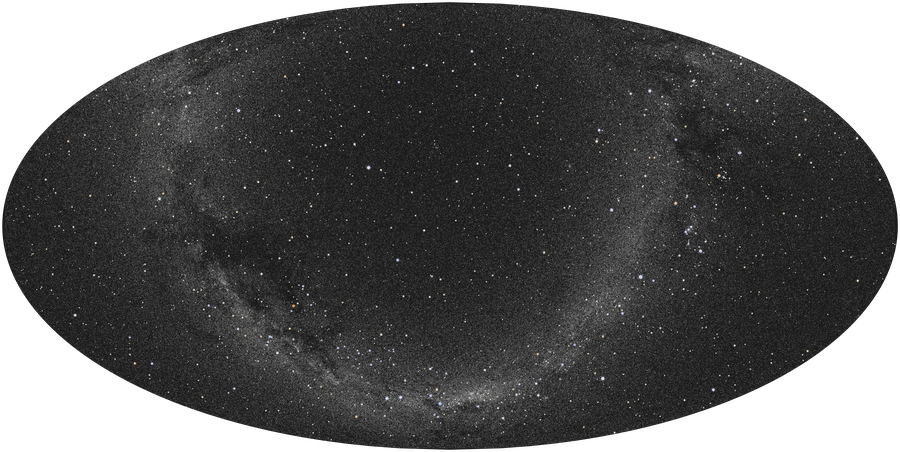
The Milky Way
-
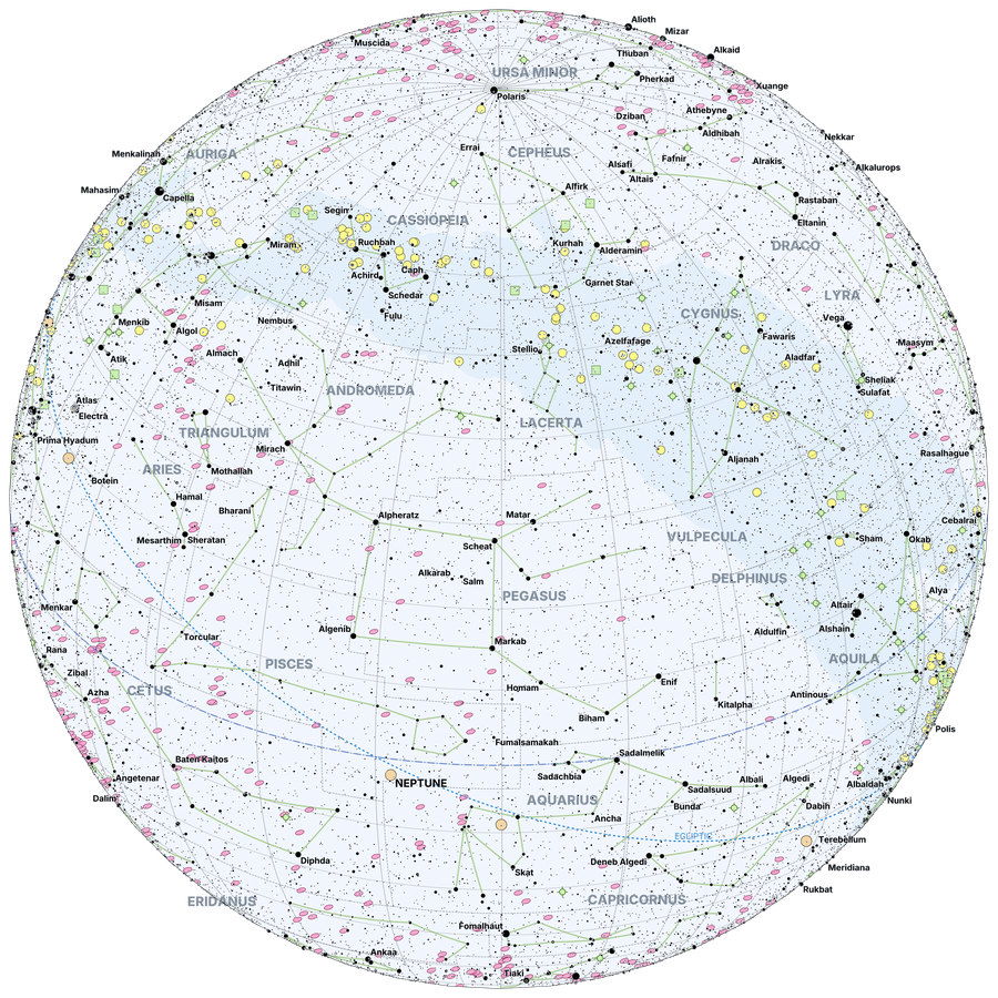
Orthographic Map
-

ISS Moon Transit
-

Star Chart in French
-
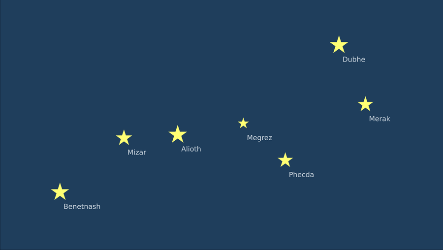
The Big Dipper
-

Galaxy Plot
-
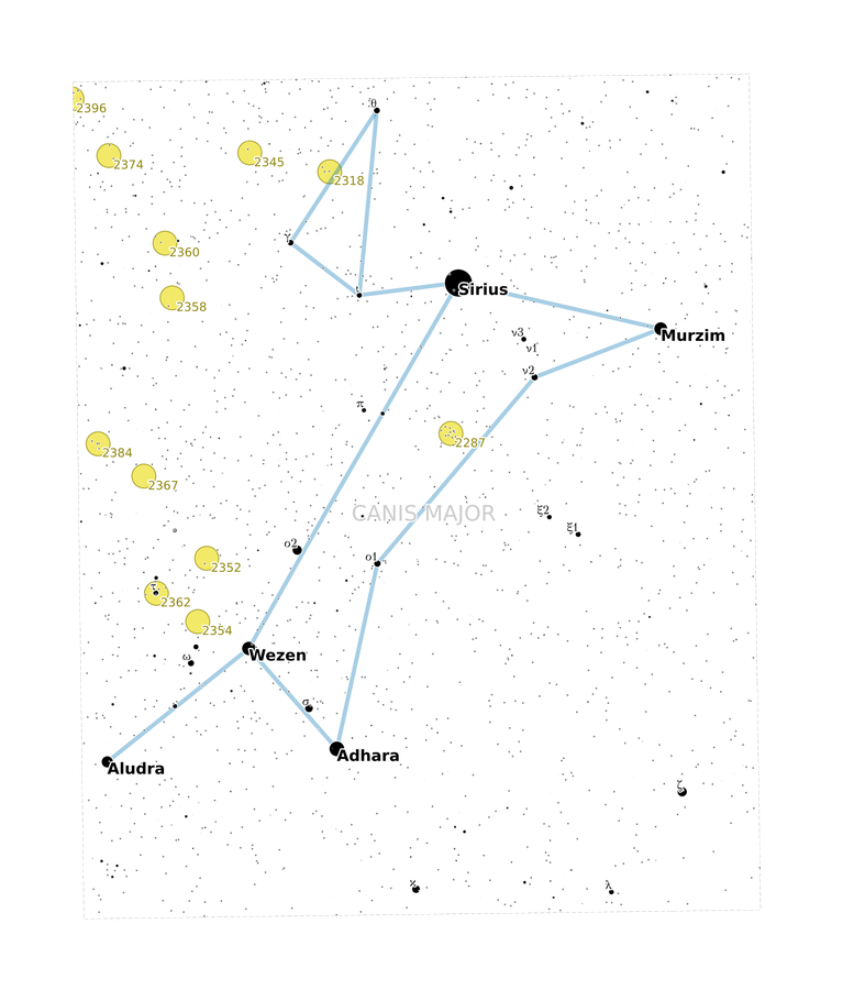
Map of Canis Major
-

Map of Cassiopeia
-

Custom Markers for Galaxies
-

Virgo Galaxy Cluster
See more examples @ Starplotting.com
Like this one that shows the path of Comet C/2025 A6 (Lemmon) in October 2025:

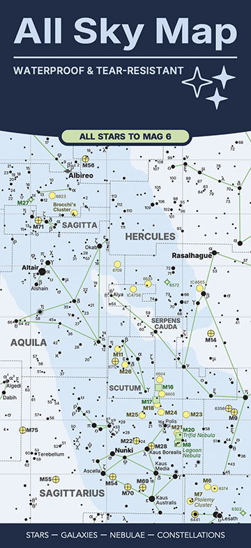
Example Publication - All Sky Map
Starplot can create publication-quality maps, thanks to its ability to export SVG files. These files can then be imported into many design applications, including Adobe Illustrator and Affinity Publisher, to create high-quality printed maps, books, etc.
One example is the All Sky Map, which is a foldable map designed and created by Steve Berardi (who also created Starplot!).
The map was created by first writing code to generate SVG files of the map and then these were imported into Affinity Publisher to fine-tune some of the label positions and add the legend, supporting text, and create the overall page layout of the map. It was then printed on synthetic paper that is waterproof and tear-resistant!

Check out the tutorial and code reference to learn more about using Starplot!